
Featured

Stocks Rip to Records as Oil Craters on Iran De-Escalation Hopes

August 5, 2026 Global markets roared into record territory Tuesday as easing fears over a Middle East oil shock sent crude prices tumbling and investors piled back into stocks. The Dow closed above 54,000 for the first time ever, the S&P 500 hit its first record high since June, and the TSX bounced back hard from its Civic Holiday closure. Here's everything you need to know before the market opens today. 🇨🇦 TSX: Back With a Bang Canadian markets reopened Tuesday after Monday's Civic Holiday closure, and investors made up for lost time. The S&P/TSX Composite Index surged 575.45 points, or 1.63%, to close at 35,801.59 — one of its strongest single-day gains of the year — clawing back all of Friday's 0.79% pullback and then some. Index Close Change S&P/TSX Composite 35,801.59 +575.45 (+1.63%) TSX Venture 898.89 +3.66% The rally was broad-based, with financials and miners leading the charge: Brookfield Asset Management jumped more than 6% after officially comple...
article

Ontario Braces for Back-to-Back Snowstorms: Travel Warnings Issued

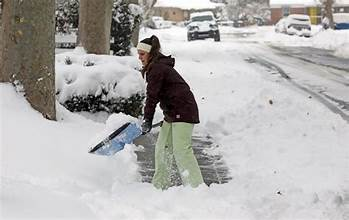
Winter is in full swing across Ontario, with three more rounds of snow expected to hit the region this week. The back-to-back storm systems are bringing gusty winds and heavy snowfall, making travel difficult and dangerous.

The first round of snow, a clipper system, has already blanketed eastern Ontario with 5-10 cm of snow, leading to school bus cancellations and winter weather travel advisories in the Greater Toronto Area (GTA). Visibility has been significantly reduced at times, prompting warnings for drivers to slow down and be prepared to stop.

As the clipper system moves out, lake-effect snow will sporadically impact southern Ontario, potentially bringing **10-20 cm of snow** locally. Another clipper system is expected to spread snow from Thunder Bay to Ottawa through Thursday afternoon, adding another 5-10 cm of snow to the mix.

The most significant event is forecasted for Thursday night into Friday, with a Texas low developing near Lake Erie. This system could bring a mix of rain and snow, changing to heavy snowfall as colder air moves in. Forecasters are closely monitoring the storm's track, as it could be quite impactful for the region.

With temperatures plunging into the minus teens by Saturday, Ontarians are advised to stay updated with the latest weather alerts and road conditions. The first few weeks of February are expected to be volatile, with an active pattern of winter systems.


Comments